
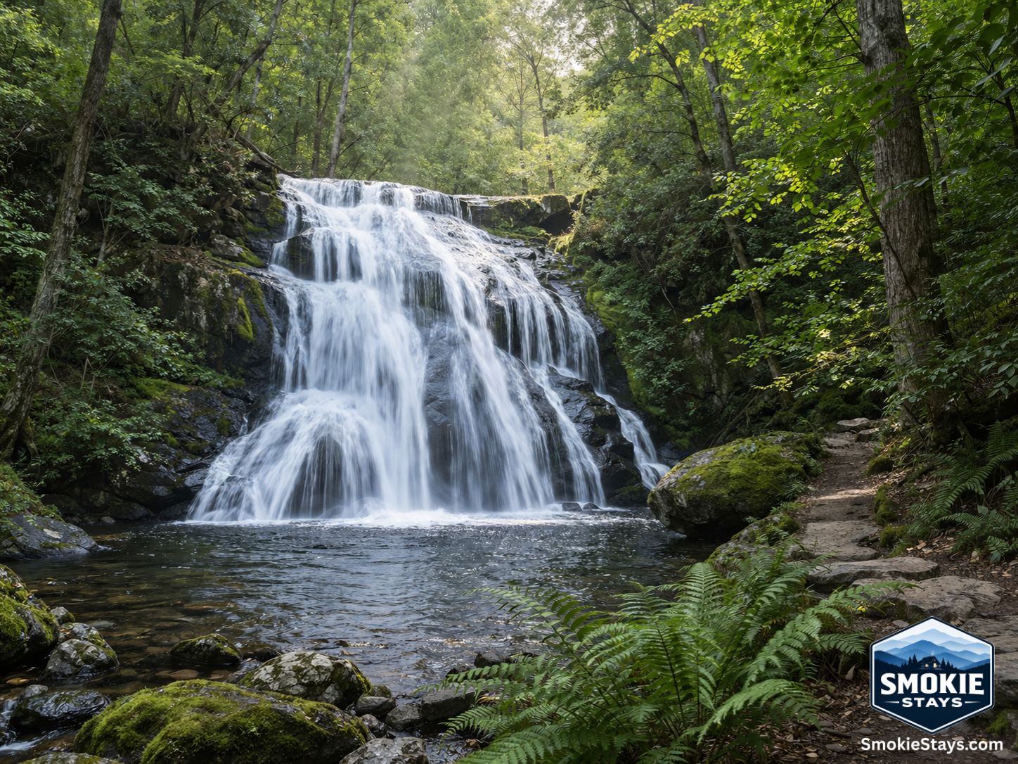
The Smoky Mountains produce waterfalls the way other mountain ranges produce overlooks — abundantly, at every scale, across every level of effort required to reach them. You can see one from your car window without slowing down, walk ten minutes on a paved path to one of the most-photographed cascades in the eastern United States, or earn a hundred-foot cascade at the end of a strenuous 8-mile round trip that most park visitors have never heard of.
The variety is part of what makes waterfall hunting in the Smokies a legitimate pursuit rather than a checkbox activity. Here's an honest guide to the best ones — organized by effort required — with the specific details that actually help you decide which one fits your trip.
A Few Things to Know Before You Go
The waterfalls listed here are inside Great Smoky Mountains National Park unless noted otherwise. Entry is free — there's no gate fee — but a parking tag is required for any vehicle parked more than 15 minutes at a trailhead. Purchase one in advance at recreation.gov or at entrance kiosks for $5 per day. Cell service disappears inside the park, so download trail maps before you leave.
Water levels matter for waterfalls specifically. Spring brings the highest flow after snowmelt and seasonal rains — every waterfall on this list looks its best in March through May. Summer flow is lower but still impressive at most falls. After a prolonged dry period, some smaller cascades thin noticeably.
Laurel Falls Trail was closed from January 2025 through summer 2026 for rehabilitation and reopening improvements. Verify current status at nps.gov/grsm before planning a visit.
No Hiking Required
Meigs Falls — Viewable from the road
Meigs Falls is one of the easiest to reach waterfalls near Pigeon Forge — an 18-foot waterfall that can be seen directly from Little River Road. As you're driving along Little River Road, look for a large pull-off area with a retaining wall to your left. From this area you can see the waterfall in the distance. The view can be partially obstructed in the summertime when the trees are fully leafed — we recommend checking it out in the winter or early spring.
It's not the most dramatic waterfall in the park, but it's visible from a moving vehicle on one of the most scenic drives in the Smokies — which makes it a reliable free addition to any Little River Road itinerary without adding any time to your day. Located about 6 miles from the Townsend Wye, heading toward Gatlinburg.
Easy Hikes: Under 1 Mile, Minimal Effort
Cataract Falls — 0.4 miles round trip, 30 feet elevation gain
One of the least-known easy waterfalls in the park and one of the most rewarding for the minimal effort involved. The trail to Cataract Falls begins at the Sugarlands Visitor Center just outside of Gatlinburg — less than a mile round trip and gains less than 30 feet of elevation, making it easy for all ages. The falls flows year-round with best water volume in spring. Starting at the Sugarlands Visitor Center also means parking is generally easier here than at dedicated trailhead lots on busy weekend mornings.
Best for: First-time park visitors, families with young children, anyone who wants a quick win before or after a Newfound Gap Road drive.
The Sinks — Short walk from the road
About five miles east from the Townsend Wye on Little River Road, The Sinks is a scenic location with heavy cascades, access to a swimming hole, and a hiking trail. The cascades here aren't a single dramatic waterfall but a turbulent series of drops through a limestone gorge — the water compresses through a narrow slot and explodes into a deep pool below. Swimming is technically permitted at your own risk — the currents are deceptively powerful at high water. In spring the volume is extraordinary; in summer the pool is refreshing.
Best for: Anyone on the Little River Road corridor, families who want water access without a long hike.
Moderate Hikes: 1–4 Miles, Real but Manageable
Grotto Falls — 2.6 miles round trip, 530 feet elevation gain
This is the waterfall with the feature that no other waterfall in the national park can claim. Grotto Falls is the only waterfall in the national park that you can walk behind. This lets you hear and feel the power of the water as it plunges into the pool below — and makes for a one-of-a-kind photo opportunity.
The trail follows the Trillium Gap Trail from the Roaring Fork Motor Nature Trail — a wide, well-worn path through old-growth hemlock forest before reaching the 25-foot falls. The waterfall itself creates a shallow cave of sorts behind the curtain of water, and the trail actually passes through it. Llamas use this same trail to carry supplies to LeConte Lodge — if your timing is right, you may pass the pack string on the way up.
Most of the trail is well-worn and wide, though there are some rocky and wet areas near the falls. Waterproof trail shoes or boots are worth wearing specifically for the behind-the-falls section.
Best for: Anyone visiting the Smokies for the first time who wants one genuinely unique experience. The walk-behind feature makes this the most memorable mid-effort waterfall in the park.
Laurel Falls — 2.6 miles round trip, 314 feet elevation gain
Laurel Falls stands as the most iconic waterfall in the Smokies, featuring a spectacular 75-foot cascade divided into upper and lower sections by a stone walkway. The unique viewing platform allows visitors to position themselves between the two tiers for unparalleled photo opportunities.
The round trip is 2.6 miles, perfect for families and beginners looking for a rewarding hike. The trail is paved its entire length and manages the elevation gain gradually rather than sharply. The falls is the most photographed waterfall in the park and for good reason — the split-tier format with the walkway crossing between them gives you a compositional angle that most waterfalls don't offer.
Verify current status before visiting — the trail underwent major rehabilitation in 2025–2026 and should be fully operational with improved facilities once complete. The improvements include repaving, new viewing platforms, and expanded parking.
Best for: Families, first-time waterfall hikers, photographers who want the most photogenic composition in the park.
Baskins Creek Falls — 3.1 miles round trip, 912 feet elevation gain
We recommend taking a picnic to Baskins Creek Falls — a 40-foot, two-tiered waterfall that cascades into a tranquil pool, providing a peaceful spot for relaxing in nature and taking photos.
The Baskins Creek Trail from the Roaring Fork Motor Nature Trail trailhead is 3.1 miles round trip and gains 912 feet in elevation — moderately difficult. The two-tiered format gives the falls a more complex composition than a single drop, and the pool at the base is one of the more inviting spots in the park on a warm day. The trail gets a fraction of the traffic of Laurel Falls and Grotto Falls, which makes the experience considerably more peaceful at the destination.
Best for: Hikers who want a moderately challenging trail with a strong destination payoff and fewer crowds than the most popular falls.
Abrams Falls — 5 miles round trip, 340 feet elevation gain
Located in Cades Cove, Abrams Falls has an unusual characteristic among Smokies waterfalls — it's not tall, but it's arguably the most powerful. Although Abrams Falls is only 20 feet tall, the large volume of water rushing over the falls makes up for its lack of height. The plunge pool at the base is one of the largest and deepest in the park, and on a sunny day the mist creates a perpetual rainbow over the pool.
The 5-mile round trip through mature hardwood forest along Abrams Creek is one of the most scenic trail corridors in Cades Cove, with the creek visible much of the way and multiple small cascades along the route before the main falls. Its powerful surge cascades down from a height of 20 feet, creating a breathtaking spectacle that captivates hikers.
Best for: Cades Cove visitors, families comfortable with a longer trail, anyone who appreciates raw water volume over height.
Mouse Creek Falls — 4.2 miles round trip, 750 feet elevation gain
Located in the Big Creek area of the park near Cosby on the northeast side — one of the least-visited and most beautiful sections of the park. At 1.4 miles the trail passes Midnight Hole, a deep, clear pool that displays colors of green and blue under six-foot tall waterfalls. At 2.1 miles, you will reach Mouse Creek Falls, where a short side trail on the left leads to a bench where you can rest and view the falls.
The combination of Midnight Hole — one of the most striking swimming holes in the park, with water so clear the depth is deceiving — and Mouse Creek Falls at the end makes this a two-destination trail that overdelivers for its distance. The Big Creek area trailhead is about 45 minutes from Gatlinburg but draws a fraction of the crowds of the Sugarlands and Roaring Fork areas.
Best for: Anyone willing to drive further for significantly better solitude, swimming hole access, and a two-waterfall day.
Challenging Hikes: 5+ Miles, Serious Elevation
Rainbow Falls — 5.4 miles round trip, 1,685 feet elevation gain
A rainbow produced by mist from the 80-foot tall Rainbow Falls is visible on sunny afternoons throughout the year. Also, during extended winter cold spells, an impressive ice formation builds around the falls for an incredible view.
The 5.4-mile roundtrip hike gains 1,685 feet of elevation, making it one of the more demanding waterfall trails in the park. Starting point is the Cherokee Orchard Road trailhead, accessible from downtown Gatlinburg via Airport Road.
The height of the falls — 80 feet, among the tallest in the park — combined with the rainbow effect on sunny afternoons makes this one of the most photographed challenging waterfalls in the Smokies. The winter ice formation around the falls is an entirely different visual that draws photographers specifically in January and February. The Rainbow Falls Trail continues approximately four miles beyond the falls to the summit of Mount LeConte for hikers who want to extend the day.
Best for: Experienced hikers, photographers targeting the rainbow or winter ice formation, hikers combining it with the LeConte summit push.
Ramsey Cascades — 8 miles round trip, 2,200 feet elevation gain
Ramsey Cascades is the tallest waterfall in the Smokies at 100 feet. This is a more challenging hike — the trail boasts the tallest waterfall in the park and the cascade falls into a small swimming hole.
The trailhead is in the Greenbrier area, about 6 miles east of Gatlinburg on US-321. After the ranger station, Greenbrier Road turns to gravel — turn left at the bridge for a 1.5-mile woodsy drive along Middle Prong of the Little River to the trailhead. The trail passes through one of the most impressive old-growth forests in the park — tulip poplars with trunk diameters you rarely see east of the Mississippi — before arriving at a 100-foot cascade that drops in multiple tiers into a boulder-strewn pool.
The combination of the old-growth forest approach and the tallest waterfall in the park makes this the most rewarding challenging hike on the waterfall list. Plan a full day — the 8-mile round trip with 2,200 feet of gain takes most hikers 4.5 to 6 hours.
Best for: Experienced hikers looking for the best combination of trail character and waterfall scale in the park. Worth every step.
Seasonal Waterfall Tips
Spring is peak season for every waterfall on this list — higher water volume, wildflowers on the approach trails, and cooler temperatures for the longer hikes. March through May is when the Smokies waterfalls are most powerful.
Summer brings lower flow but warmer temperatures that make swimming holes at Midnight Hole and Abrams Falls genuinely appealing. Arrive before 9 a.m. at popular trailheads — Grotto Falls and Laurel Falls in particular fill early on summer weekends.
Fall offers excellent conditions for waterfall hiking alongside foliage color on the approach trails. Water levels have recovered from summer low points by October.
Winter is underrated for waterfall visits — crowds are minimal, lower-elevation trails are accessible, and Rainbow Falls' ice formation is a winter-only experience worth planning around.
Planning Your Stay
The Gatlinburg corridor puts you closest to most of the waterfalls on this list — Grotto Falls, Laurel Falls, Rainbow Falls, and Baskins Creek all start from the Roaring Fork Motor Nature Trail or nearby trailheads within 20 minutes of downtown. Cades Cove waterfalls (Abrams Falls) are about 45 minutes from Gatlinburg via Little River Road. Ramsey Cascades and Mouse Creek Falls require slightly longer drives into the Greenbrier and Big Creek areas respectively.
We keep a small, hand-picked portfolio of cabins across the Sevierville, Pigeon Forge, and Gatlinburg area — take a look at what's available for your visit at smokiestays.com/cabins.
Trail conditions and waterfall access change seasonally and after storm events. Laurel Falls Trail was closed for rehabilitation in 2025–2026 — verify current status before visiting. Always check the National Park Service website at nps.gov/grsm for current trail conditions, road closures, and parking tag requirements before your hike.