
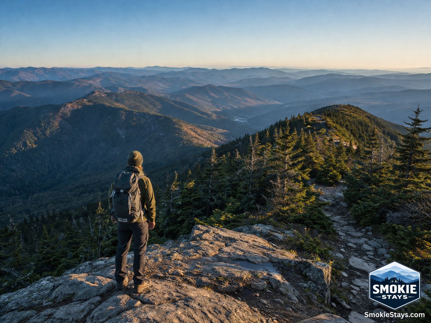
Great Smoky Mountains National Park draws more visitors than any other national park in the country — over 12 million a year — and the majority of them never leave the overlooks on Newfound Gap Road. That's not a criticism. The views from those overlooks are genuinely worth stopping for. But it does mean that the park's 800-plus miles of trail are considerably less crowded than the parking lot statistics suggest, and the best hiking in the Smokies rewards anyone willing to walk more than a quarter mile from the car.
The trail network here spans every level of fitness and ambition — from flat, paved waterfall walks appropriate for toddlers to 14-mile ridge traverses with 3,000 feet of elevation gain that will earn every step. Here's an honest breakdown of what to expect, organized by difficulty, with the specific details — distances, elevation, time, and what makes each trail worth the effort — that make the difference between a good hiking day and a great one.
Before You Go: Practical Basics
Entry is free. Great Smoky Mountains National Park charges no entrance fee — one of the very few national parks that doesn't. What is required is a parking tag for any vehicle parked more than 15 minutes at a park trailhead or overlook. Tags are purchased at recreation.gov in advance or at fee kiosks at park entrances — $5 per day or $15 per week. Buy one before you leave cell service range.
Arrive early. The most popular trailheads — Laurel Falls, Alum Cave, Clingmans Dome, and Abrams Falls in Cades Cove — fill their parking areas on peak season weekends before 9 a.m. Arriving at 7:30 or 8 a.m. is not overpreparing; it's the difference between parking and driving back to Gatlinburg to try again.
Download offline maps. Cell service disappears once you're inside the park. Download the AllTrails or Gaia GPS maps for your intended trails before you leave, or pick up a paper map at a visitor center.
Bears are real. Black bears are most active from dawn through mid-morning, with over 1,500 bears calling the park home. Store all food in your vehicle or a bear canister, never on the trail or at a campsite. Maintain at least 150 feet of distance if you encounter one.
Laurel Falls Trail status. Laurel Falls Trail was closed from January 2025 through summer 2026 for rehabilitation, including repaving, adding viewing platforms, and expanding parking. As of mid-2026 the reopening was expected — verify current status at nps.gov/grsm before making it the centerpiece of your trip.
Easy Hikes: Under 2 Hours, Minimal Elevation
Gatlinburg Trail — 2 miles round trip, 100 feet elevation gain
The most accessible hike in the park and the only trail where leashed dogs are permitted alongside the Oconaluftee River Trail. The Gatlinburg Trail begins at the Sugarlands Visitor Center and follows the West Prong of the Little Pigeon River toward downtown Gatlinburg, passing remnants of old homesites along the way. It's flat, partially paved, and appropriate for strollers and young children. The connection to downtown means you can use it as a walking alternative to driving into Gatlinburg on a busy day — park at Sugarlands and walk in.
Best for: Families with young children, dog owners, first-time park visitors.
Clingmans Dome Observation Tower — 1 mile round trip, 330 feet elevation gain
Technically a short walk rather than a hike, but the payoff is the highest point in the national park and one of the most spectacular views in the eastern United States. The paved half-mile trail from the parking area to the observation tower gains 330 feet in a short distance — it's steep enough that some visitors underestimate it — but the summit view extends up to 100 miles on a clear day. Clingmans Dome provides panoramic views after a steep half-mile climb. The Kuwohi Road that leads to the trailhead closes in winter (typically December through March) — check seasonal road conditions before planning a cold-weather visit.
Best for: Anyone who wants high-elevation views with minimum trail time. Go early — the parking lot fills fast.
Cove Hardwood Nature Trail — 0.75 miles round trip, minimal elevation
A short loop through one of the finest stands of old-growth cove hardwood forest in the park, starting near the Chimneys Picnic Area off Newfound Gap Road. The trail passes through trees that were old when the park was established — yellow buckeye, white basswood, and tulip poplars that dwarf most East Coast forests. In spring it's carpeted with wildflowers; in fall the color display is exceptional. Under an hour, appropriate for all ages, and consistently underused compared to nearby trails.
Best for: Spring wildflowers, fall foliage, old-growth forest appreciation.
Moderate Hikes: 2–4 Hours, Real Elevation
Laurel Falls Trail — 2.6 miles round trip, 314 feet elevation gain
The most popular waterfall in the Smokies — when open, this is the most photographed waterfall in the park. The trail is 100% paved and accessible. Laurel Falls itself is an 80-foot cascade that splits into two tiers, accessible by a well-maintained paved path that makes it one of the most approachable waterfall hikes in the park. The trail is paved its entire length and manages significant elevation change without feeling technical. Verify reopening status at nps.gov/grsm before visiting — the trail underwent major improvements in 2025–2026 and should be better than ever once complete.
Best for: Families, first waterfall hike in the park, accessibility.
Porters Creek Trail — 4 miles round trip, 700 feet elevation gain
Porters Creek Trail threads past the Elbert Cantrell farmstead, Ownby Cemetery, and a cabin the Smoky Mountain Hiking Club built in the mid-1930s. It gets a fraction of the traffic that Laurel Falls draws, yet the historical texture rivals any trail in the park. The first 1.5 miles follow an old road grade along the creek — nearly flat and exceptionally scenic — before the trail steepens toward Fern Branch Falls. In April and May, the trailhead meadow and surrounding forest floor are among the most concentrated trillium displays in the entire park. Located in the Greenbrier area off US-321, about 15 minutes east of Gatlinburg.
Best for: Spring wildflowers, historical character, avoiding crowds on a moderate trail.
Abrams Falls Trail — 5 miles round trip, 340 feet elevation gain
One of the most popular trails in Cades Cove and consistently one of the most rewarding moderate hikes in the park. The trail rolls through mature hardwood forest alongside Abrams Creek, with multiple stream crossings and a final descent to a 20-foot waterfall that drops into one of the most dramatic plunge pools in the Smokies. The falls aren't the tallest in the park — Abrams Falls drops only 20 feet — but the volume of water and the setting make the experience memorable. Abrams Creek holds the largest rainbow trout in the park.
Best for: Families comfortable with a longer trail, Cades Cove visitors, fishing enthusiasts.
Alum Cave Trail to Alum Cave Bluffs — 4.6 miles round trip, 1,400 feet elevation gain
The first half of the full Alum Cave Trail to Mount LeConte, and an excellent moderate destination in its own right. The trail passes through a unique geological sequence: Arch Rock, a narrow tunnel through a natural stone arch; Inspiration Point, an open ridge with views across the valley; and the Alum Cave Bluffs, an 80-foot overhanging concave bluff that shelters a microhabitat of rare plants. The Alum Cave Trail strings together Arch Rock, Inspiration Point, and the Alum Cave Bluffs — you can turn around at the bluffs for a moderate day or push to one of the highest summits.
Best for: Geology enthusiasts, photographers, hikers who want a challenging moderate trail with a clear turnaround point.
Spruce Flat Falls — 2 miles round trip, 500 feet elevation gain
Located just across from Tremont Visitors Center, Spruce Flat Falls covers only 2 miles roundtrip and drops to a 30-foot main cascade. Almost no competitor article mentions it. If you want a genuine low-crowd waterfall experience, this is the one to prioritize. The trail climbs through a mixed forest of mature hemlocks and tulip poplars, with the creek audible most of the way. The falls itself is a tiered cascade in a hemlock-shaded gorge — one of the most photogenic spots in the park that most visitors have never heard of.
Best for: Avoiding crowds, waterfall photography, hikers who've done the popular trails and want something new.
Challenging Hikes: Half Day to Full Day, Serious Elevation
Alum Cave Trail to Mount LeConte — 11 miles round trip, 2,763 feet elevation gain
If you only do one hike, it's the Alum Cave Trail toward Mount LeConte — the most popular because it packs the most dramatic scenery into the most direct route. The full trail to the LeConte summit is an 11-mile round trip with nearly 2,800 feet of elevation gain — a serious undertaking that rewards the effort with the third-highest summit in the park and views that span multiple states on a clear day. LeConte Lodge near the summit is the only backcountry lodge in the park, operating by reservation for overnight guests. If you're not staying overnight, plan for a 6–7 hour round trip with early departure.
Best for: Experienced hikers, anyone who wants the definitive Smokies summit experience.
Chimney Tops Trail — 4 miles round trip, 1,400 feet elevation gain
One of the steepest trails in the park relative to its distance — the Chimney Tops gain 1,400 feet in just 2 miles, with the final quarter mile involving scrambling over rock to the exposed summit. The summits themselves are twin rocky pinnacles with 360-degree views of the surrounding ridgeline — genuinely dramatic in a way that most Smokies trails aren't. The trail was heavily damaged in the 2016 Chimney Tops wildfire and has been rebuilt and improved since reopening. Expect the upper section to be challenging regardless of fitness level.
Best for: Experienced hikers comfortable with rock scrambling, summit views, high elevation gain.
Gregory Bald via Gregory Ridge Trail — 11.4 miles round trip, 3,000 feet elevation gain
One of the park's best-kept secrets among serious hikers. Gregory Bald is an open grassy summit with 360-degree views of Cades Cove below and the full arc of the Smoky Mountain ridgeline in every direction. In late June, the bald is covered in flame azalea in full bloom — one of the most spectacular wildflower displays in the entire Appalachians. The trail is long and gains significant elevation, but the summit payoff rivals anything else in the park. Access is from the Cades Cove area.
Best for: Experienced hikers, late June flame azalea bloom, the best summit views in the western park.
Mount Cammerer via Low Gap Trail — 11.2 miles round trip, 2,700 feet elevation gain
Mount Cammerer sits at the northeastern corner of the park near Cosby, and its summit features a historic stone fire tower perched on an exposed rocky outcrop with some of the most dramatic views in the entire Smokies. The trail is long and gains significant elevation but is less crowded than the Alum Cave approach to LeConte. The Cosby area generally is one of the most underused sections of the park — the campground, the trailheads, and the surrounding forest all see a fraction of the traffic that the Gatlinburg-adjacent trails absorb.
Best for: Experienced hikers who want big views and minimal crowds, historic fire tower photography.
Seasonal Considerations
Spring (March–May): The best wildflower season, with peak blooms moving upward by elevation from late March through May. Porters Creek and the Greenbrier area for trilliums; Gregory Bald for flame azaleas in late June.
Summer (June–August): Highest crowds and warmest temperatures. Start early, arrive at trailheads before 8 a.m., and consider higher-elevation hikes where temperatures are 10–20 degrees cooler than valley towns.
Fall (September–November): Peak foliage season draws significant crowds, particularly in October. Mid-week visits and early morning starts are the best crowd mitigation. The upper-elevation trails show color first — Clingmans Dome and the Alum Cave Trail ridge are peak in early-to-mid October.
Winter (December–February): The quietest season, with minimal crowds and bare canopy that opens views normally hidden by summer foliage. Kuwohi Road and the upper sections of Newfound Gap Road may close in icy conditions. Lower-elevation trails remain accessible year-round.
Planning Your Hike
A cabin base camp in the Gatlinburg area gives you the shortest drive time to the most popular trailheads — Sugarlands Visitor Center, the Alum Cave trailhead, and the Chimneys Picnic Area are all within 20 minutes of downtown Gatlinburg. Cades Cove trailheads (Abrams Falls, Gregory Bald) are about 45–50 minutes from Gatlinburg via Little River Road.
We keep a small, hand-picked portfolio of cabins across the Sevierville, Pigeon Forge, and Gatlinburg area — take a look at what's available for your visit at smokiestays.com/cabins.
Trail distances, elevation gains, and conditions are subject to change. Some trails may be closed seasonally or for maintenance. Always verify current trail status at the official National Park Service website nps.gov/grsm before your visit. A parking tag is required for all vehicles parked more than 15 minutes inside the park — purchase in advance at recreation.gov.